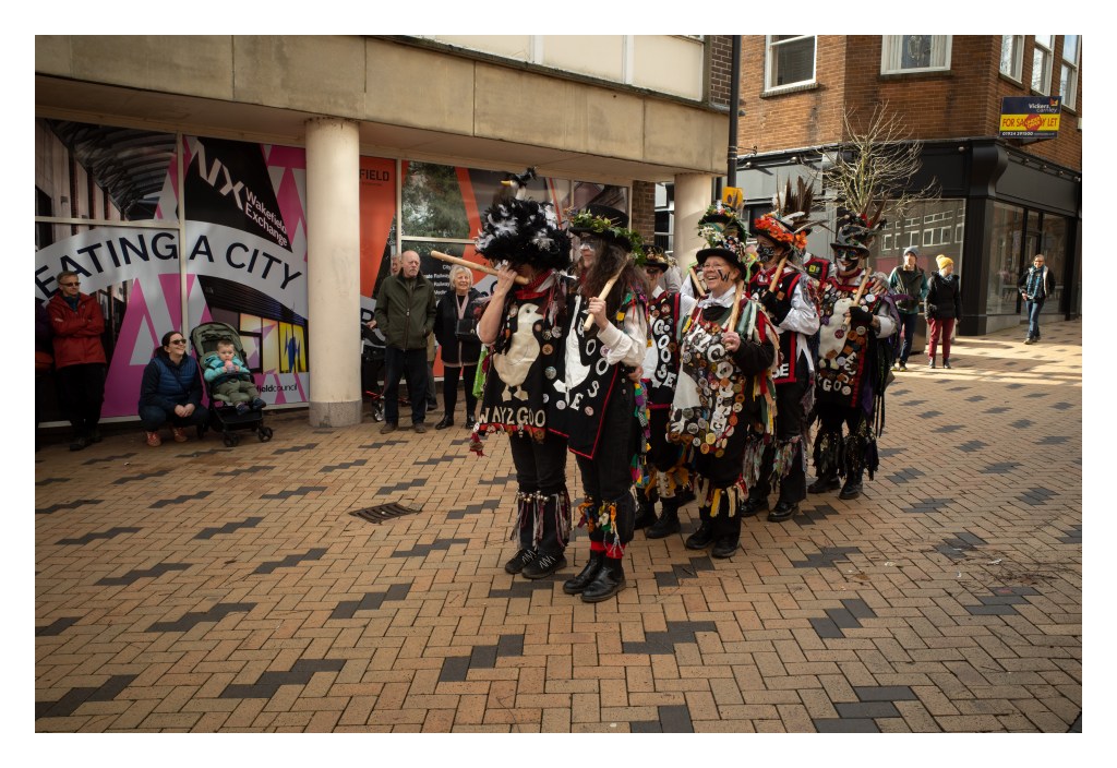
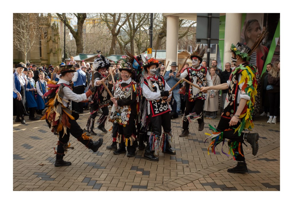
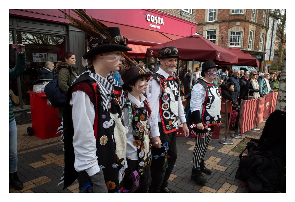
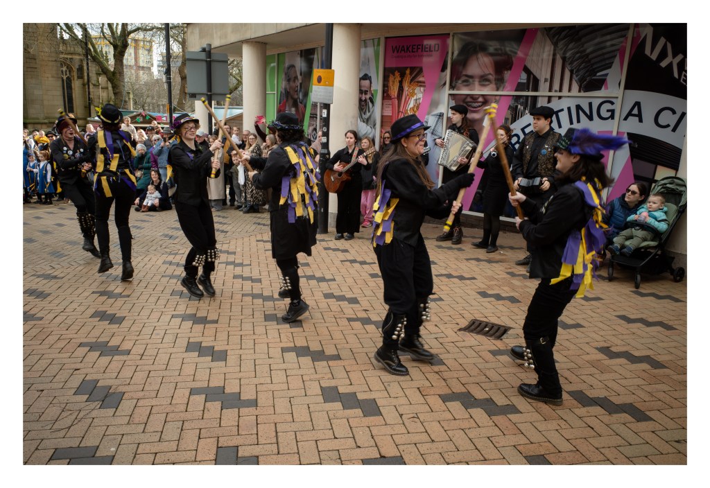
My wife and I visited the Wakefield Rhubarb Festival today. It’s the first time we’ve been and it was an enjoyable few hours out.
Wakefield is one of the towns that delineate the area known as the Rhubarb Triangle*, famed for producing forced rhubarb, a method of growing the vegetable in dark sheds which encourages the plants to convert carbohydrates into glucose, forming stalks with a sweetly sour taste. Rhubarb has many uses, but is often served in sweet pies and crumbles,sometimes accompanied by other fruits. Wakefield Council holds the annual festival each February.
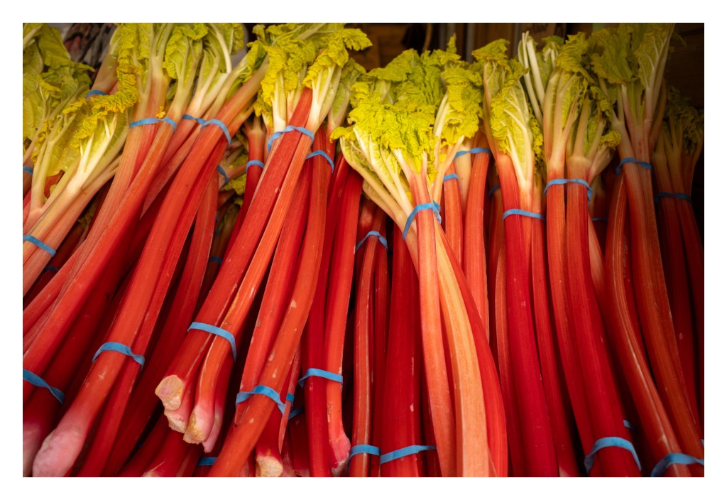
Fresh bundles of rhubarb on one of the stalls.More rhubarb being delivered
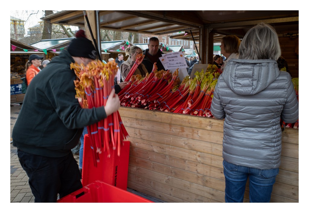
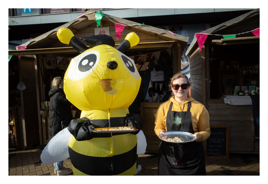
The event itself was somewhat akin to a Christmas market and I was surprised at how many stalls were present, along with various activities taking place, and local bars, cafe’s, and restaurants also laying on rhubarb themed food and drinks. We bought a number of items, including some orange and rhubarb marmalade (I’m on a bit of a marmalade voyage of discovery at present, having it with toast for breakfast several times a week), some rhubarb candles (which my wife will gift to a friend), a sausage and rhubarb focaccia (to be eaten tomorrow!), and some fresh stalks of rhubarb (some of which we ate with custard this evening).
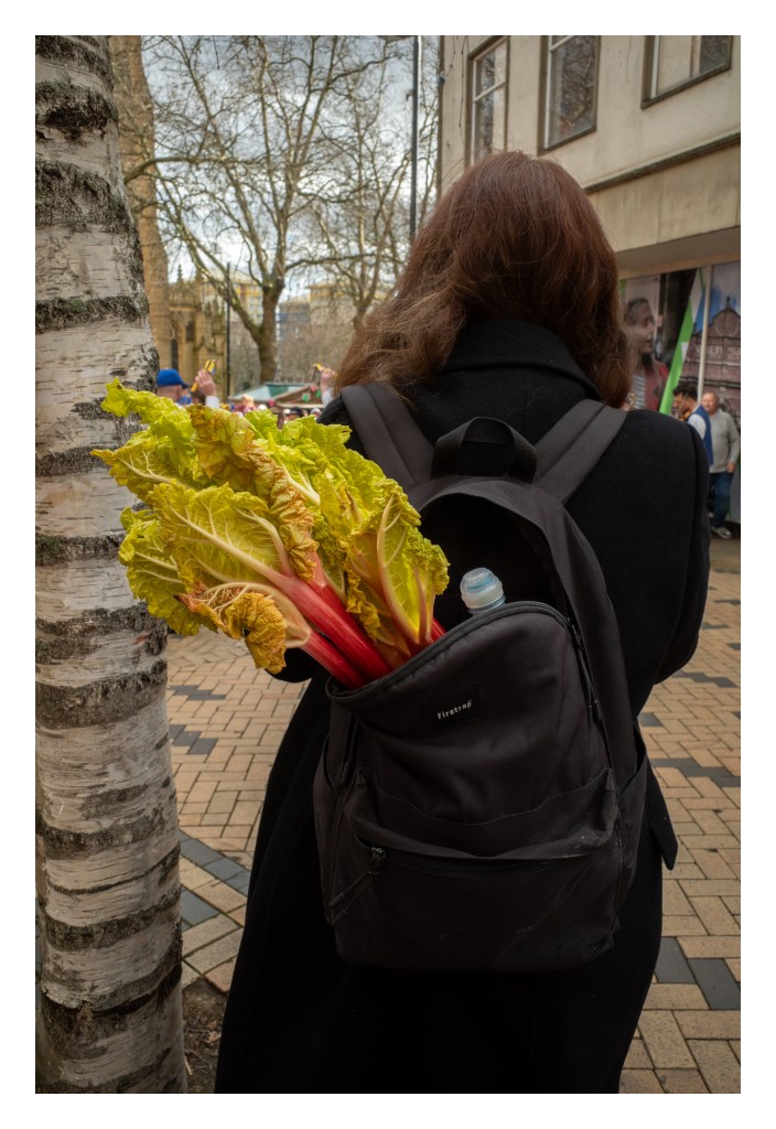
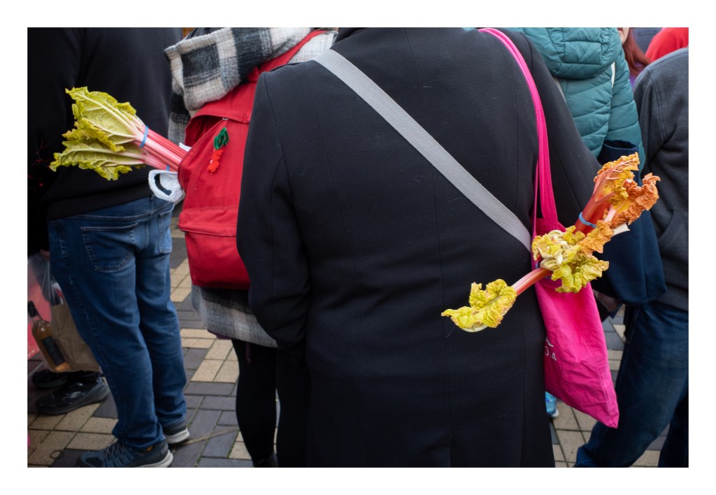
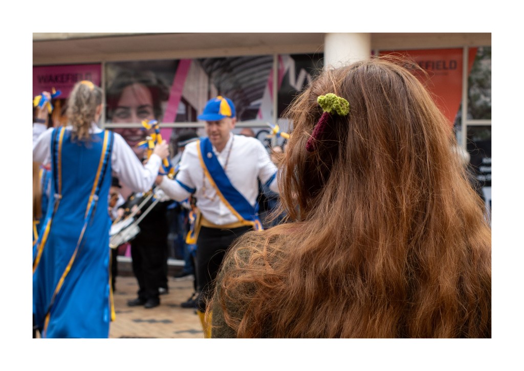
Two friendly rhubarb ladiesEverywhere you looked, people had stalks of purchased rhubarb protruding from bags and backpacks.More rhubarb purchasersA girl with rhubarb in her hairThere was honey for sale too
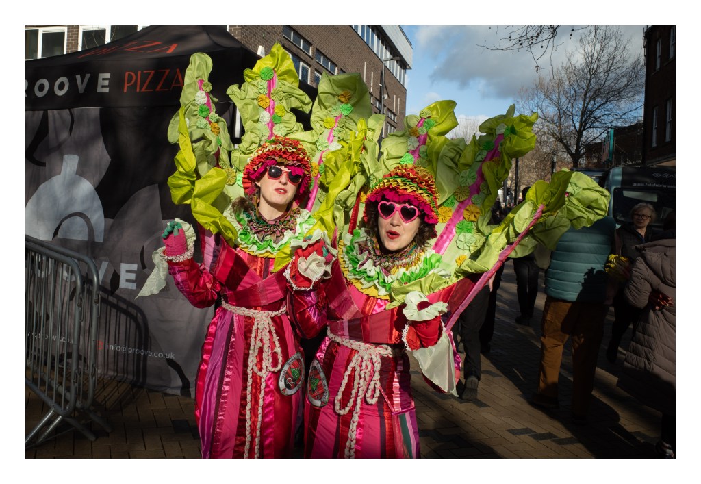
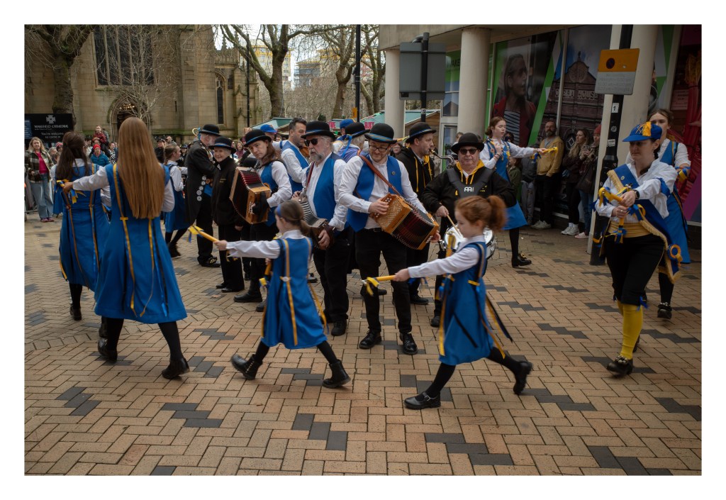
As well as the stalls, there were a number of other events taking place during the event (which ran from Friday until today), including live music, arts and crafts, cooking demonstrations, various performers in rhubarb costumes, and no less than three different morris dancing groups (or sides, as I believe they are known) .
*the legal definition of the Rhubarb Triangle is apparently as follows…
“from Ackworth Moor Top north along the A628 to Featherstone and Pontefract. Then on to the A656 through Castleford. It then goes west along the A63 past Garforth and West Garforth. Head north passing Whitkirk, Manston and on towards the A6120 by Scholes. Follow the A6120 west, round to pass Farsley which then leads south west via the A647 onto the A6177. Pass Dudley Hill to pick up the M606 south. At junction 26 take the M62 south to junction 25 head east along A644 toward Dewsbury, passing Mirfield, to pick up the A638 towards Wakefield. At Wakefield take the A638 south to Ackworth Moor top.”[
And so we reach the final set of pictures from my trip to Spurn Point.
The first three pictures are of the lifeboatmen’s (lifeboatpersons?) houses that were visible in my picture from the top of the lighthouse in yesterday’s post. They were built in 1975 and replaced the original cottages that dated to 1819. There are now no lifeboat crews based at Spurn with the service being covered from Grimsby and the new inshore lifeboat station at Cleethorpes.
And then a final set of pictures featuring the lighthouse. The first shot is probably my favourite of the whole trip. The Ultramax has produced some subtle but nice colours. The window at the top of the lighthouse is tinted and opens into the upper floor of the building (below the light) where there is a display on view.
So that’s the final post in this set. Spurn (and the Holderness coast) is somewhere I’d wanted to visit for a long time, and it’s somewhere I’d like to return to. There are lots more pictures to be had. Maybe I’ll get another chance next year.
Olympus 35 RC and Kodak Ultramax. Lab developed. Home scanned and converted with Negative Lab Pro.
On to the final set of black and white photos I made at Spurn Point. Following directly on from yesterday the first two images are of the views from the top of the lighthouse. It’s not possible to go outside and you have to stand on the platform where the light itself once stood in order to see out of the windows properly, but the views are good. I actually quite like the effect of the “leading” on the glass.
This first shot is the view looking back up the spit towards the Holderness coast (where the land disappears off the left middle edge of the frame). You can see the road, plus the sandy eastern beach, and the tidal mud flats to the west.
Looking the other way (roughly south east) gives a view of the tip of the point with the Humber estuary and the Lincolnshire coat beyond. The road is clearly visible as it makes it’s way to the former lifeboatmen’s houses. The sea traffic tower stands in the middle of the scene, and one of the Humber sea forts can be found at upper right.
Looking to the west give a view of the old lighthouse with its water tank cap. Some people were digging for bait on the mudflats and their electric bike can be seen.
After descending the steep steps of the lighthouse (not easy with a heavy backpack and a tripod!), I treated myself to an ice-cream and then set of towards the tip of the point, first following the road towards the sea traffic tower..
Beyond the tower the land gives way to dunes and a series of sandy footpaths. There are numerous ex-military buildings in various states of repair in this area.
As I reached the beach at the end of the point I turned round and took this photo looking back the way I’d come.
The beach at the end of the point shows clear signs of the tidal forces that come into play when the water is high, the sand sculpted into channels and craters. The fisherman who I’#’d earlier seen digging bait can also be seen putting it to use.
And the final shot from this roll shows a freighter heading up the estuary past the end of the point. This is a relatively small vessel and much larger ships pass through this channel.
The final set of Spurn Point photos to come tomorrow, this time in exciting colour! 🙂
Nikon F80, Tamron 28-300mm F/3.5-6.3 Di VC PZD on Fujifilm Acros. Ilfotec DD-X 1+4 9mins @ 20°.
Other than a couple of electric bikes, the only mode of vehicular transport I saw while walking to the end of Spurn Point was this Unimog all-terrain truck, which carries passengers from the Yorkshire Wildlife Trust centre to the lighthouse.. It has to traverse the soft sands of the beach at the neck of the point until it can rejoin the remaining road that hasn’t been washed away by the sea. Here it is heading back north.
There are a number of trails leading from the beach, up over the dunes, and to the road. This one looks a little overgrown.
After crossing the road I stuck to the western side of the spit which is mostly flat, grassy terrain with a scattering of gorse and some bird-watching shelters overlooking the tidal mud flats of the estuary.
Given the length of the walk to the end of the point, it’s good to see a bench along the way. My telephoto lens has compressed the distance a little and it’s further to the lighthouse from the bench than it might appear in this shot.
Also present are the reamains of some WW2-era tank traps.
IAs I got closer to the lighthouse I made a number of photographs.
More to come tomorrow, including views from the top of the lighthouse!
Nikon F80, Tamron 28-300mm F/3.5-6.3 Di VC PZD on Fujifilm Acros. Ilfotec DD-X 1+4 9mins @ 20°.
Switching cameras and film for the next bunch of photos from this trip…
You can just see the north sea in the shot, but I took this one because I liked the weather-vane goat.
A view north from the top of Spurn with rough conditions (although they didn’t seem so bad further down the point). The “promontory” jutting out to sea is actually the remnants or concrete wartime structures that have fallen as the cliffs recede due to coastal erosion.
A few miles out to sea stands a large offshore wind farm, something that has become a common sight from the North Sea coastline.
I wasn’t the only photographer on Spurn Point that day…
I wonder how much time has passed since this section of brick wall fell into the sea? I’m quite impressed at how well it is maintaining its structural integrity. Perhaps it will become a large and intricately patterned pebble some day.
More groyne remnants…
And another view of the remains of man’s efforts to hold back the tides…
Among the other debris, there were a number of lobster pots washed up on shore (or shortly about to)…
There are lots of pieces of chalk scattered across the seaward beaches of Spurn Point. These have most likely been transported south from the exposed chalk cliffs at Flamborough, almost fifty miles up the coast (although the entire Holderness coast is under laid with a bedrock of Cretaceous chalk, this is mostly covered by glacial till).
Nikon F80, Tamron 28-300mm F/3.5-6.3 Di VC PZD on Fujifilm Acros. Ilfotec DD-X 1+4 9mins @ 20°.
Today’s shots were also taken with my GW690, although on a different roll of film: Some Kentmere 400. Unlike the Fomapan 400, there were no defect on this roll, plus I avoided any potential bromide drag by using standard development with regular inversions. I’ve shot a couple of rolls of Kentmere 400 now and both times I’ve found it gives quite bright results and I have to drop the highlights a little. Not sure if it’s a feature of the film, or the way I’m developing it.
The first four shots were taken around the tip of Spurn Point showing the beach and dunes beside the estuary opening. In the shot of the dunes you can just make out an old sea fort dating back to the first world war in the distance. There are two forts: Bull Sand fort, and Haile Sand fort. I think the one in the picture is the former. The structure in the fourth shot is the sea traffic monitoring station. I’m not sure if it’s still manned at all, but the radar is active and the tubular antenna at the top of the building was constantly rotating.
The next four shots are of groynes and other sea defences, or what remains of them at least. These are no longer maintained, with the land now left to natural forces. You can see the battering that the man made defences have taken from the tides. I particularly like the final shot where pebbles have been jammed between the boards of a groyne by the force of waves and resulted in what reminds me of some sort of aquatic abacus.
Spurn Point is a location I’ve wanted to visit for a long time. It’s a spit of land that extends from the Holderness coast in Yorkshire into the mouth of the Humber estuary. It is a slender piece of land three miles in length, widening at it’s southern tip, but being less than 50 metres wide at it’s narrowest point.
At times during its recorded history, storm tides have breached the neck, cutting off the tip and forming an island. The last breach was, I believe, back in 2013 which destroyed the single road to the tip making it passable only by foot or all-terrain vehicles (such as a Unimog truck that ferries tourists to the lighthouse and back).
The Holderness coast, and Spurn, are subject to significant coastal erosion (spurn being the beneficiary of the material eroded from further up the coast) and this has affected the geography of the location over time with various settlements lost to the sea in past centuries.
Spurn has been used for a number of purposes over it’s history, including coastal defence, lifeboat station, and the location of lighthouses and traffic control for shipping passing in and out of the Humber. It is now owned and managed by the Yorkshire Wildlife Trust and attracts a large number of visitors keen to experience the creatures, particularly birds, that make their homes there.
There are two lighthouses still standing on Spurn, both now decommissioned – Smeaton’s high light, and Walker’s low light. The Walkers lighthouse stands in the mud flats to the west of the strip of land, it’s light aparatur removed and replaced by a water tank. Smeatons light stand on the land of the spit and is open to tourists, and you can climb the narrow staircase to where the light was once installed. Other noteable structures include the lifeboat crew houses, which are also empty, the tall shipping control tower with its still active radar, the old lifeboat jetty, and various structures remaining from wartime.
I made pictures with three cameras across four rolls of film, so I’m going to split them into batches. This first set were shot with my Fujica GW690 (Texas Leica) on Fomapan 400. Sadly, the pictures were affected with a defect giving a lot of white speckles on the final images. This was also compounded by bromide drag when I developed them, although I’ve Photoshopped the worst of this away. Despite these setbacks, they still have a certain charm to them, I think.
I thought I’d go alliterative with the title of today’s post. 🙂
Two pictures taken close together and as consecutive frames of boats on the beach at Blanes (those six words, and indeed the title of the post, make for tricky tongue-twisters. As does the phrase “tricky tongue-twisters” for that matter!)
The first picture was the second one I shot, and my favourite of the two by far, and managed to find its way into Flickr’s Explore section when I posted it. The colours are nice and it reminds me of the French flag (although blue, white, and red stripes are used in a multitude of other national flags too).
The second shot is nice too, but lacks the vivid colours of the first and loses some impact as a result.
Olympus Trip 35 & Kodak Pro Image 100. Lab developed. Home scanned and converted with Negative Lab Pro.
Today was less eventful than yesterday and I didn’t kill any birds (although I’ve probably crushed multiple tiny invertebrates beneath my feet purely in the act of walking around).
It was the annual Classics on the Moor car show in Sheffield today, so I went along and shot a couple of rolls with my Yashica Mat. The camera drew the attention of a number of people, including some other photographers – one who was making street portraits with a Rolleicord.
I’m in a position again of having a lot of undeveloped pictures. The tally is currently: 3 rolls of film scanned and waiting to be uploaded online, four rolls of B&W film to be developed, scanned, and uploaded (2 x 120 6×6 & 2 x 36exp 135), two rolls of 120 6×6 C41 to be developed, scanned, and uploaded, and then three rolls of film partially shot in different cameras (1 x 120 6×6, and 2 x 36exp 135). That’s around 180 photos not including the rolls I’ve yet to finish.
I don’t think there will be a drought of pictures for the blog for a while…
Olympus Trip 35 & Kodak Pro Image 100. Lab developed. Home scanned and converted with Negative Lab Pro.
I decided that I would have a day of photography today. I had to drop my son off at work at 7am so it meant I would have a decent early start, although I wasn’t looking for sunrise shots or anything (a good job, as sunrise was an hour earlier, and it was overcast anyway).
I’d decided to drive to Halifax, a town in West Yorkshire which I haven’t visited before, but which I knew had a bunch of interesting old mills and the like to photograph. The quickest way to get there is to take the M1 north, before heading west on the M62.
The first of the day’s lows came mere minutes after dropping my son at work. As I was driving towards the M1 junction I noticed a car ahead that seemed to be driving a little erratically. It kept suddenly slowing down, and I initially wondered if it had some sort of mechanical fault, but I soon realised the fault was with the driver, who I assume didn’t really know where they were going. The best course of action in this situation would be to find a suitable place to stop, and then take stock of your route. Unfortunately, the person driving this car took a more extreme action. As they got to the roundabout where the slip road to the M1 northbound is located they turned onto the slip road and then came to a complete stop. Vehicles come around this roundabout at quite high speed, many traveling in excess of 55mph, so having a vehicle block one of the lanes on the sliproad could be a potentially catastrophic event. I was able to pull around the stopped car without too much difficulty, but I could already hear angry beeps from cars behind me affected by the foolish driver.
This obstacle behind me, I proceeded on my journey. However, only a few minutes passed before the next low came calling. I was travelling at maybe 65mph when I saw a pigeon fly from the side of the motorway and land about thirty feet in front of my car. At the speed I was going there was nothing to do to avoid it and, even though I saw it begin to take flight, I hit it with an awful thump and the poor thing went tumbling across a couple of lanes of the motorway, trailing feathers. I felt horrible. I don’t like harming animals, and to have killed one in this way, even though I couldn’t avoid it, made me feel very sad and guilty. This wasn’t a good start to the day, and most definitely not a good start for the unfortunate pigeon.
After a somewhat subdued but uneventful remainder of the journey, I arrived at my destination. As with many towns that grew during the industrial revolution, there are a large number of old mills and factory buildings. Although most have now been repurposed for things like accommodation, office space, and retail use, they are still impressive and interesting structures, and there were plenty of things to photograph. Added to the buildings, there is a network of high overpasses in the area that curve above the valley floor like something out of Mega City One, making for a bunch more interesting photo opportunities. The weather wasn’t as I had expected (sunshine and clouds), instead being largely overcast, but I think these conditions probably suited the black and white photography I was doing.
After shooting a couple of rolls of film I decided to go find a cafe and get a drink and, as I was walking through the town centre, I noticed a police car besides which an agitated looking man and woman was speaking to the officer and gesturing to the building behind them – a jewelry shop occupied the ground floor, and above were another three floors of unknown use. I heard to woman talk about a fire, and what sounded like there being a gas cylinder in the room. Within a minute smoke had begun to emerge from a first floor window. More police arrived and started to make people retreat from the scene, saying there was a danger of explosion. Some people were still approaching the scene and were told in no uncertain terms to “get back!”.
Soon a huge amount of smoke began to emerge from the windows, reeking of whatever was burning in there, for a short period reducing visibility down the entire street, and the orange glow of flickering flames could be seen behind the smoky glass. Shortly afterwards a fire-engine turned up and soon a fireman was spraying water through the first floor windows. After a few minutes of this, the smoke started to diminish and more fire-officers entered the jewelry shop on the ground floor, having to rip open a security shutter to gain access. After watching for a while longer (and having taken a few photographs) it seemed like everything was under control and I decided to move on and find the cafe I was looking for.
Luckily, this was the extend on the bad event that happened during the trip (although I’d have preferred it had none of them occurred).
There was something good that happened on the way home though…
Rather than take the quickest route back, I decided to take a more circuitous way on the hope that I’d find something interesting to photograph with the two remaining shots on the roll of film in my camera. After ignoring the demands of Google Maps and instead taking random diversions that looked like they might lead somewhere interesting (or at least somewhere I’d never been before) I, by chance, arrived at Castle Hill just outside Huddersfield, Castle Hill is the site of a Bronze Age hill fort, but more prominently, the 100ft tall Victoria Tower. I’ve seen the tower from afar before, but never been close to it, and today I was able to not only photograph it, but also climb to the top (or as high as you’re allowed to go at least).
The pictures from today will appear here in due course once I’ve developed and scanned them all. Loads of stuff still to come before then though.
Anyway, in lieu of those, here are some completely unrelated pictures of the rocky coastline at Lloret de Mar…
Olympus Trip 35 & Kodak Pro Image 100. Lab developed. Home scanned and converted with Negative Lab Pro.