
Continuing from yesterday, the second part of this post will cover the leg of the journey from Stoney Middleton back to Eyam.
The footpath I had been following enters Stoney Middleton via backstreets. Where this street merges into another named The Fold, there is a sign affixed to a wall pointing the way back to Eyam to those unsure of the route


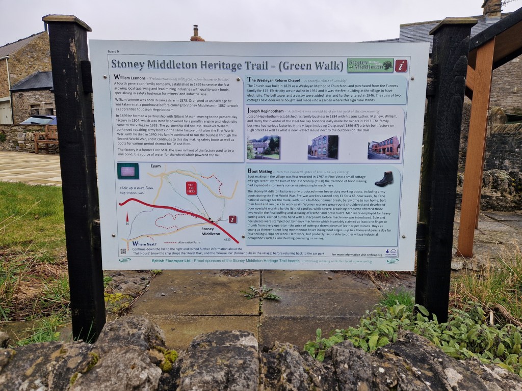
At the bottom of The Fold there is a small open area where Dale Brook flows before disappearing beneath the William Lennon and Co boot factory. The building was formerly a corn mill before William bought it in 1904 along with the Mason brothers, forming Mason Bros & Lennon, where they began repairing, and then manufacturing boots. The factory still operates and is in the hands of Williams great grandchildren, focusing on retro footwear produced using traditional techniques.

The western end of this grassy area is separated from the grounds of the boot factory, and contains a sapling planted to commemorate the Diamond Jubilee of Elizabeth II. Here also sits Toll Bar Fish & Chips, from which a very tempting aroma was drifting. I’ve had chips from here once before and they were very good, but on this occasion it was still a little early for lunch.

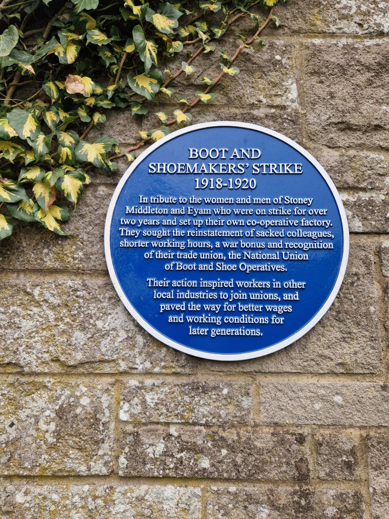
More heritage trail signs are present, as well as a blue plaque on the side of the Boot factory remembering the Boot and Shoemaker’s Strike between 1918-1920.
The next shot shows some houses across the road from the chip shop, illustrating the precipitous nature of parts of the village.

St. Martin’s church was the next landmark on my walk. The church was open to visitors and I went inside and made a few pictures with my Yashica Mat 124G, which I’ll post on another occasion. The church is quite unusual in that the nave is octagonal, which you can just about make out in the picture below.

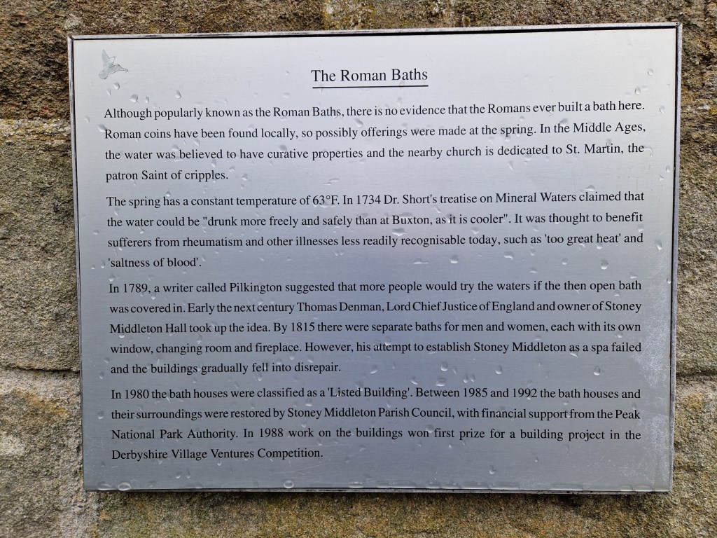
On the road past the church is a small building with a spring flowing beside it. The structure is known as the Roman Baths. I didn’t photograph it, but grabbed a quick picture of the plaque outside with my phone camera.
At the end of this road the tarmac ends and I was back onto a track again. Near the bottom is a cemetery containing Commonwealth War Graves. It has a mossy lychgate that made for an interesting picture.

From here the track, and old packhorse trail, ascends quite quickly. It’s rocky and bumpy and soon had my legs aching and my lungs panting. The next photo is looking back the way I came. This section was a bit less steep.

At the top of this track is a road, and there is a footpath through the fields on the other side that continues the ascent. Again, this next shot was a look back the way I had come.

At the top of this path is a wooded area with the trail eventually joining Riley Road. This road runs back towards Eyam and is thankfully downhill all the way, but near the top it passes a field which is the site of the Riley Graves. This small enclosed graveyard contains the gravestones of seven members of the Hancock family who lost their lives as a result of the plague within seven days of one another in August 1666. Elizabeth Hancock buried her husband and six of her children here. After the plague passed, Elizabeth moved to Sheffield with her remaining son.

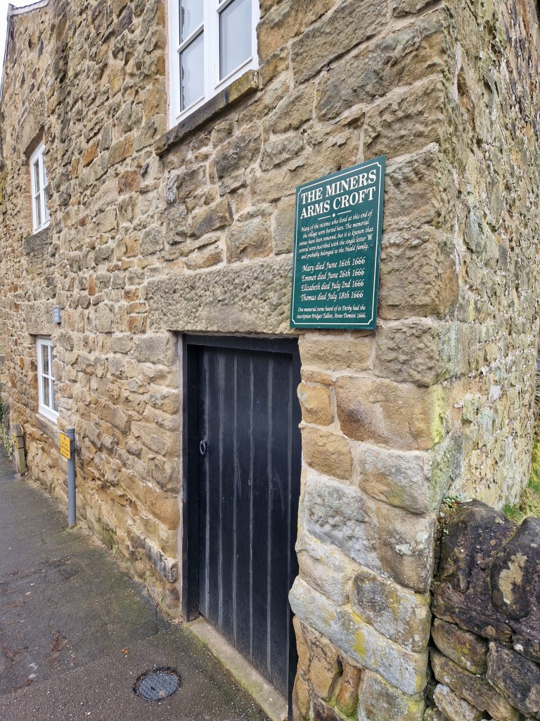
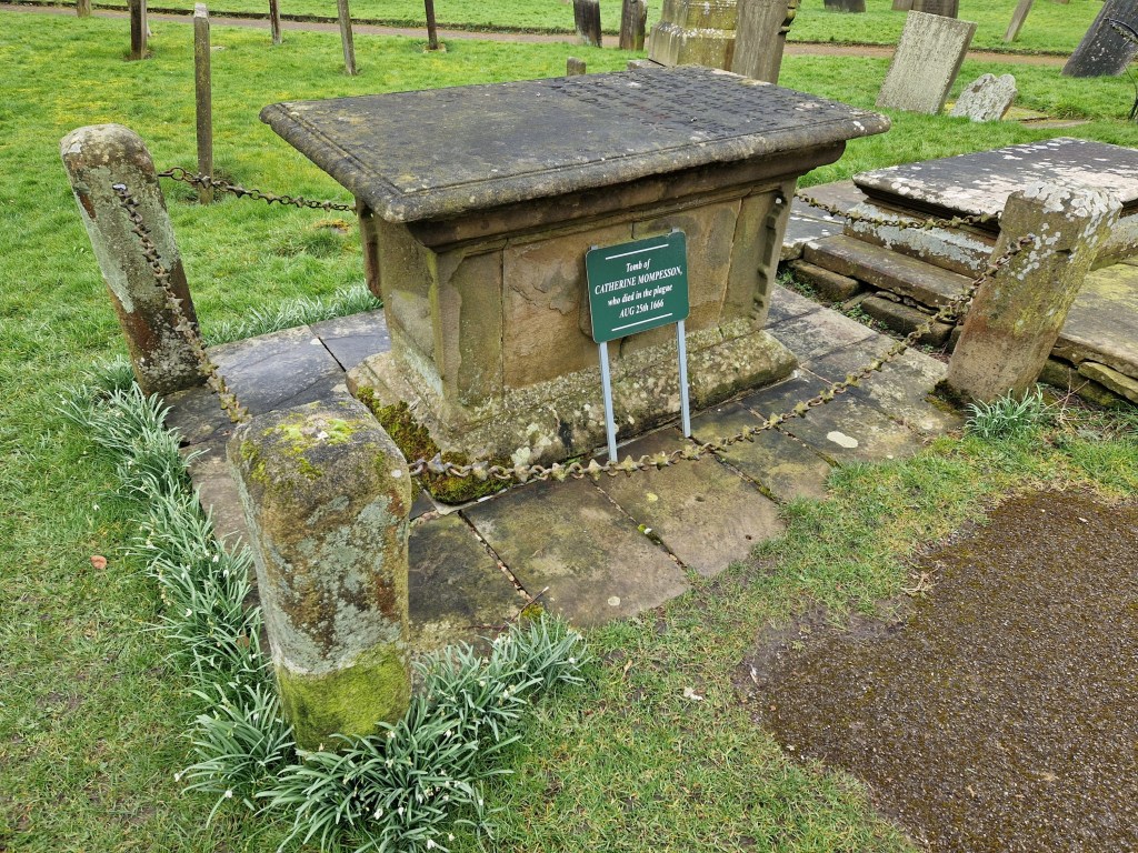
Many of the buildings and places in Eyam have information plaques affixed, providing information on the events of the plague, such as these at The Miner’s Arms and within the parish church graveyard.
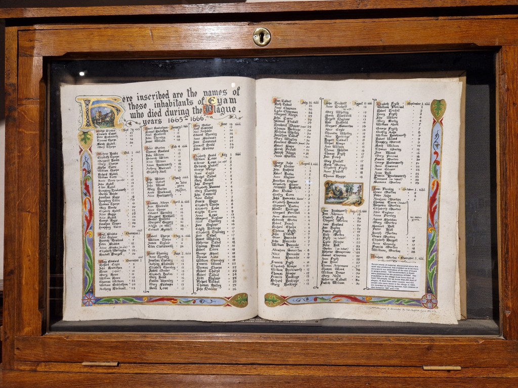
Within the church can be a found listing the inhabitants of the village who fell victim to the plague.
On that sad note I’ll bring this two-part post to a close. I plan on doing a bunch of these walks this year (indeed, I’ve already done three more!), so look out for those soon.
Olympus XA3 & Ilford HP5+ (@800asa). Ilfotec DD-X 1+4 10mins @ 20°
Taken on 9 March 2024
