This “amusing” play on the Alec Guiness WWII movie title has been forced upon my readership once before. But this is a different bridge, so I’ll wheel out the rubbish joke once more. 🙂
Cross the River Wye Prisoners of war might not Have built this one though
I have a week off work and aim to get some photography in the bag while I have the chance. Today I decided to head out into the Peak District and go for a hike.
I chose a location that I’ve not visited before, the village of Tideswell. Or, rather, Tideswell would be on my route. I studied my map beforehand and planned a circular path that would take me from Tideswell Dale car-park (about a mile below Tideswell itself), down the dale to the bottom where it meets Miller’s Dale. The route then followed the River Wye up Miller’s Dale until I would head north up Monk’s Dale. At the top, where the dale meets a road, I’d head back east and then cut through the footpaths in the pastures back to Tideswell, and then back to my car.
The hike would be around six miles, albeit with a lot of altitude to lose and gain along the way, including some steep climbs. While not a long hike, I knew that my backpack and tripod would add some weight and make it more strenuous than if I were travelling light. The part I didn’t really factor into my plans was the trail through Monk’s Dale. Whereas the earlier sections of the walk had been on well defined and surfaced tracks, the path through Monk’s Dale is somewhat more basic. For much of the dale it hugs the stream that runs down the valley and is very scenic, but today, after quite a lot of heavy rain, the path was quite slick with surface mud and I had to keep careful watch on my footing. Further up the valley though is where it got more serious…
Here the path enters into a steep-sided section of the dale which is densely wooded. Over time, the limestone cliffs on either side have shed rocks and boulders which litter the valley bottom and the footpath becomes a half-mile endurance test where every step is a potential sprained ankle, broken hip, or worse! My hiking boots have a nice tread that grips well on many surfaces but, as I found out today, not on worn limestone rubble. It probably took me the best part of an hour to traverse this section of the route, the trees all heavily matted with thick coats of almost orange moss, and I was beginning to think I’d actually lost the footpath and was now just clambering over rocks beside the stream bed (luckily, the water that had been flowing further down the valley was no longer in evidence here, presumably taking an unseen subterranean route through the porous limestone).
I was becoming quite hot from the exertion and sweat was dripping down my face and at one point I almost took a tumble, thoughts about how long I might lay there undiscovered if I became incapacitated flashing across my mind. Thankfully, if this had been the place where I took a fall, I’d have been seen as I then noticed a man nearby examining plants in the undergrowth a little further up the path – he was the first, and only, person I saw on this whole section of the walk, the only other evidence of anyone having passed by being a set of someone else’s footprints that I noticed from time to time in the mud. I stopped to catch my breath, wipe the sweat from my brow, and chat with the man for a while. He’s been to a dental appointment that morning and decided, as he was passing on his way home, to take a look at the valley as it was the first time he’d visited in some time. He was able to tell me that I was maybe more than half-way through the difficult stretch (I’d have preferred to be near the end, to be honest :)) and at least reassure me that this was, indeed, still the actual path.
Continuing along the trail, the way began to become a little easier, albeit still with treacherous footing and the occasional fallen tree to clamber over or duck under, and I eventually managed to reach the open field close the the road. While the worst was behind me, the road itself had a punishing camber that really made my thighs put in the work. The remainder of the route took me through a patchwork of pasture fields back over to Tideswell. I eventually reached the village and found a cafe where I bought myself a sandwich and a slice of “farmhouse slice” – a very tasty shortcacke concoction filled with a selection of juicy dried fruits to eat when I got back to the car – my treat for all the effort!.
The remainder of the route was all downhill back to the carpark and it was with a real sigh of relief that I sat back in the car.
I shot a couple of rolls of film through the Yashica Mat 124G, plus several frames of 35mm with my OM-2. As ever with my blog, these will turn up somewhere down the way after I go through my existing rolls (I have a pretty strict, OCD-style, queuing system for publishing photos if you hadn’t noticed! 🙂
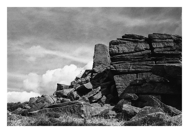
Anyway, to keep things on a bit of a related track, here’s another Peak District photo, this one of Over Owler Tor and a different part of the park. These are gritstone rocks and my boots don’t slip on those!
How long would I lay Undiscovered in the woods If I took a fall?
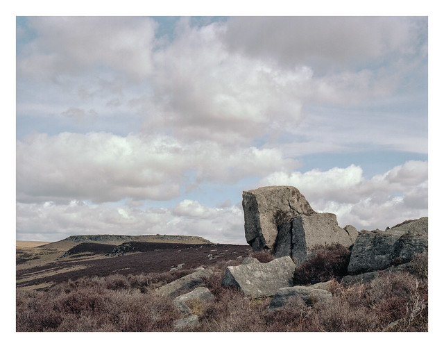
I crunched through the dry, brown heather to get this cluster of rocks in the right place to frame this landscape photo of the moors looking over to Higger Tor, which can be seen in the distance at centre-left. It was approaching lunchtime when I made this picture – long after the golden-hour had passed – but there’s something to be said for capturing images at this time of day. It’s often the time and light when people are out and about and so depicts scenes as many of us will usually see them
Tumbled and jumbled Boulders litter the landscape On Peak District moors
Bronica ETRSi, Zenzanon 75mm f/2.8 PE & Kodak Portra 160.
A blossom laden tree and stone built house make for an attractive scene. Although 6×4.5 is pretty small where medium format film sizes are concerned, I’m always happy with the quality of the photographs produced by the Bronica ETRSi.
Blossom on the trees Soon to fall in white cascades Herald of summer
Bronica ETRSi, Zenzanon 75mm f/2.8 PE & Kodak Portra 160.
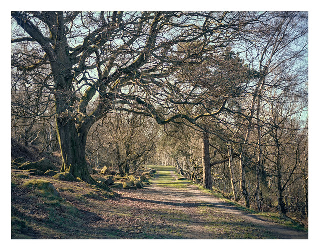
This is the track that leads to Bolehills Quarry. On the left, just beyond the tree, you can see a stockpile of abandoned millstones. Presumably this is where they were stored before being transported elsewhere, and here they remain since the market fell away, gathering coats of moss and lichen and providing something nice to look at as you pass by.
Abandoned millstones Lining the route to Bolehills In the spring sunshine
Bronica ETRSi, Zenzanon 75mm f/2.8 PE & Kodak Portra 160.
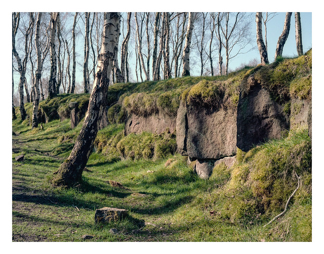
Bolehills Quarry, up above Padley Gorge, is carpeted with lush grass and beautiful silver birch trees. It’s a location that likely suits pretty much any type of conditions. The trees cast stark shadows in bright light and look mysterious in mist. These two shots were made around 9-10am while the sun was still striking long shadows.
I scanned these using EpsonScan, which is not something I normally do with colour photos as I’ve been less than successful at getting nice colours from the results in the past. This time though, I think it’s worked very well. Maybe not perfect – I doubt I’ll ever be sure a colour scan is “perfect” – but still a result I’m very happy with.
The Bolehills birch trees White trunks cast shadows on green In the morning sun
Bronica ETRSi, Zenzanon 75mm f/2.8 PE & Kodak Portra 160.
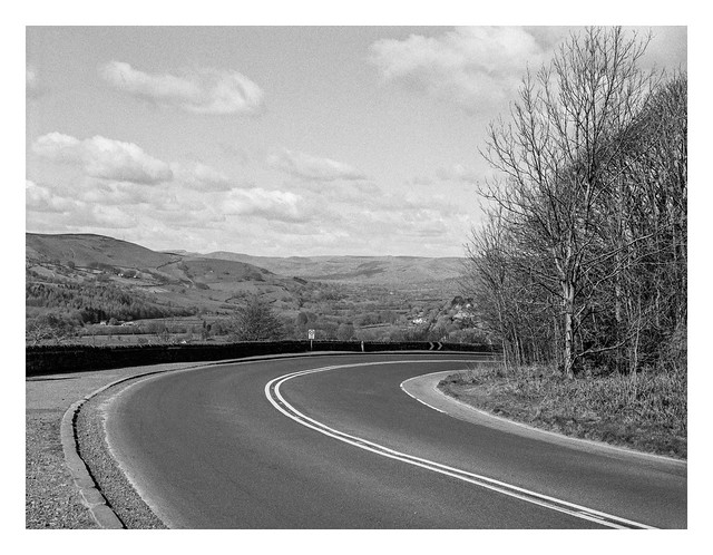
This is the A6187 road at Hathersage Booths, before curving and descending into Hathersage itself. It has a wonderful overview of the Hope Valley stretching into the distance with Mam Tor (the “Shivering Mountain”) just coming into view as part of the distant peaks. Mam Tor translates as “Mother Hill” and is so named because one side of it is prone to frequent landslides. The resultant debris has given birth to a number of smaller hills on the lower slopes.
Into Hope Valley A beautiful view to see During the descent
I’d estimate I was perhaps halfway up the side of the valley when I made this photo, climbing from the River Derwent at the bottom up to Over Owler Tor – the highest point on my walk that day. The house that can be spied beyond the gate sits on the main Sheffield to Hathersage road.
Thighs aching, I walk My ascent up the valley To my origin
A saw this tree as I was beginning my climb back up the side of the Hope Valley towards where I’d parked the car. A small cluster of Wood Sorrel – sometimes known as Fairy Bells – had found a home in the mossy surface of the tree trunk.
On this April day My eye was drawn to flowers At home on a tree