Switching cameras and film for the next bunch of photos from this trip…
You can just see the north sea in the shot, but I took this one because I liked the weather-vane goat.
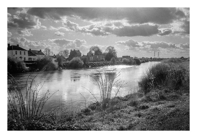
A view north from the top of Spurn with rough conditions (although they didn’t seem so bad further down the point). The “promontory” jutting out to sea is actually the remnants or concrete wartime structures that have fallen as the cliffs recede due to coastal erosion.
A few miles out to sea stands a large offshore wind farm, something that has become a common sight from the North Sea coastline.
I wasn’t the only photographer on Spurn Point that day…
I wonder how much time has passed since this section of brick wall fell into the sea? I’m quite impressed at how well it is maintaining its structural integrity. Perhaps it will become a large and intricately patterned pebble some day.
More groyne remnants…
And another view of the remains of man’s efforts to hold back the tides…
Among the other debris, there were a number of lobster pots washed up on shore (or shortly about to)…
There are lots of pieces of chalk scattered across the seaward beaches of Spurn Point. These have most likely been transported south from the exposed chalk cliffs at Flamborough, almost fifty miles up the coast (although the entire Holderness coast is under laid with a bedrock of Cretaceous chalk, this is mostly covered by glacial till).
Nikon F80, Tamron 28-300mm F/3.5-6.3 Di VC PZD on Fujifilm Acros. Ilfotec DD-X 1+4 9mins @ 20°.
My recent day trip to Castleton was shared with a group of online friends who I know from a photography forum. I’ve been on similar outings in the past, but this was the first one since the covid pandemic.
I’m normally a lone-wolf when it comes to photography. I can immerse myself in what I’m doing without distraction, and I find I rarely make my best pictures if I’m with company. However sometimes it’s nice for photography to be a shared experience, especially when your companions share the passion and (sometimes) the disappointments. Even more so when they are fellow film shooters.
It was a good day and I hope to repeat it before too long.
This is the fourth of these posts where I document a hike along the the photos I took along the way. This also marks the first walk that went quite awry…
The walk I chose on this day was centred on the village of Carlton in Lindrick in Nottinghamshire, about fifteen miles or so to the east of where I live. The route is just over seven miles in length with a slight elevation of 214 feet. It forms a rough elongated figure-of-eight laid on its side, with a country estate at the eastern (Hodsock Priory) and western (Wallingwells Hall) sides of the route.
After parking in the village, I looked at my map and set off along the westward loop. This was a mistake – had I looked at the map properly I would have seen that I should have headed east first. Not that this matters in the grand scheme of things – I would still see the entire route and end up back where I started, no matter which way I set off. This didn’t happen though, for reasons I’ll get into later…
I began my walk along the main road through the village, passing the methodist church and Sherwood Ranger pub.
A little further down the road I took a left turn where the footpath headed behind a row of houses/
The weather in preceding days had been rainy and it didn’t take long before the dirt path became slick and muddy, necessitating an awkward walking stance where I tried to keep my feet on the grass at either side of the path. Despite this, my boots soon had an extra layer of mud clagging up the soles. A few portions of the path had paving laid, but these sections were few and far between.
The path eventually led into an area of woodland that bounded the housing. The shelter of the trees hadn’t kept the path dry however, and the muddy and occasional slippery progress continued. The resolution of my map and lack of obvious signposts also led me astray, sending me further into the woods before backtracking to the path I should have followed beside a field with horses. I would soon be cursing the existence of such creatures.
The path beside their field was overgrown with shubs heavy with moisture that I had to push past. I also discovered that my new, lightweight hiking trousers, were definitely not nettle-proof when I was stung several times through the material! After passing a house and some farm buildings, eventually the path met a narrow lane, terminating in a stile, and the picture below shows the way I had come
Crossing the lane, I rejoined the footpath. Despite nothing saying so in the weather forecast that I’d checked before leaving the house, it now began to rain. The lightweight mid-layer jacket I was wearing was water-resistant, but not water-proof, so I stood beneath a tree for a while hoping to avoid getting soaked. The tree just concentrated the rain into larger, heavier droplets though, and I had to resort to putting on the waterproof shell jacket that I’d fortuitously stored in my backpack. The picture below doesn’t really do justice to the rain that was falling, but you can see how waterlogged the fields were.
I pressed on and the path soon widened. At first this looked like a welcome change as there would be more space to avoid the muddy parts. Unfortunately, what this actually signified was that I was now on a bridlepath. One that had been traversed by multiple horses and was resultingly far more muddy. Showing thoughtfulness, some of the riders had chosen to ride their steeds on the grassy edged of the path, making those parts similarly difficult to traverse for pedestrians. In places there was no option except to hop and leap between the less sludgy areas, often sinking six inches into the waterlogged earth. If you ride horses in this area and felt your ears burning on that day, that was probably my curses causing it. The next picture shows one of the less waterlogged bits!
At this point I was still following the mapped route and took a left turn past a building that I presume was a horse ranch to follow it’s course. Thankfully the rain had passed at this stage and the sun was now visible overhead again. It was soon to warm to wear my waterproof coat so, after shaking off the water, I had to slip it back into a pocket in my backpack. I also got a view of Wallingwells Hall. Despite this being listed as a feature of the walk, I can’t say that it was worth the trouble I’d endured to reach this point, it being barely visible between some distant trees.
The next part of the path initially looked like it would be easier going – a grassy track between two horse pastures. It soon became apparent that this was as waterlogged as the earlier sections of the route though. If anything, the soft ground was deeper with water than anything I’d yet traversed and I was soon forced to try and support myself by grabbing fence posts (while trying to avoid the helpfully electrified strip that ran along the top of one side of the fence). After about a hundred meters of this particular adventure, I came upon a section of the path that was completely submerged from side to side for about ten feet or so. I ran through a number of ways I might pass this new obstacle, but the mental risk assessment going through my head saw no scenario that didn’t involve my feet becoming completely submerged above the tops of my boots. Reluctantly I had to make my way back the way I had come. Imagine my joy when, while grasping a fence post for support, I put my hand in a big deposit of bird shit!
After consulting my phone for an alternative route, I set off once more, this time planning to avoid any bridlepaths and, if possible, stick to paved routes. At least by this time the weather had brightened considerably. The next photograph I took was, as chance would have it, of a horse. I wonder if this was one that had churned the paths I’d taken into quagmires?
I soon passed a small group of houses, including this pleasant looking abode.
Thankfully, the paths along the section of the route back towards Carlton in Lindrick, while not dry, were at least much less muddy than those in the former sections.
The light was now quite nice and the next picture is my favourite from the walk (even if I did then take another wrong turn just after I shot it).
The final unpaved part of the route was a track through a field of oil seed rape which was just starting to show its vivid yellow flowers (not that you can tell with this black and white photograph). In the distance you can see Carlton in Lindrick returning to view.
A former watermill was one of the first sights to greet me upon re-entering the village.
Shortly beyond the mill is a pleasant looking gate house.
To the right of this was a grand looking house with the village church beyond.
At the end of this lane I rejoined the main road again. Despite this actually being just the halfway point of the hike, my feet were wet and I’d really had enough. I had no reason to expect more of the same muddy paths if I continued, so instead I popped into the Sherwood Ranger to give my hands a good wash and buy a welcome beer before heading back home. I might return and so the walk again at some point, but I will take great care to ensure it’s after a good spell of dry weather!
Part one of this walk ended as I passed through a small area of woodland that marked the turning point where the circular route began its return back towards the starting point. Perhaps the most well known landmark on this leg of the journey is Robin Hood’s Stride, but before I got there I took a small detour to Nine Stones Close (also known as The Grey Ladies), a small neolithic stone circle that stands beside a tree in a nearby field.
There’s something fascinating and a little eerie about stone circles, both in their age, and the limited understanding we have as to why they were constructed, but also – in large part – the fact that they feature heavily in a number of fantasy / sci-fi movies and TV shows I’m fond of, notably the 1979, John Mills starring, Quatermass series, The Children of the Stones, and the Doctor Who story, The Stones of Blood. All heady material for the youngster I was back when all three aired.
After admiring the stone circle (you can see some more photos I took here), I set off back towards Robin Hood’s Stride, first passing a couple of lone trees, one dead, one alive.
Robin Hood’s Stride is a gritstone rock formation, notable for the two pinnacles at the eastern and western end. The pinnacles are named “Weasel” and “Inaccessible” and legend has it that Robin Hood was able to jumped between them in, hence the name of the formation. All I can say, is that Robin Hood must’ve had some sort of Olympian-level jumping skills as the two pinnacles are around fifty feet apart!
Unfortunately, when I arrived the sun was to the south, backlighting the rocks to a degree, so I wasn’t able to photograph the whole structure in the best light. I took several other close-up shots of part of the formation though, including some carved graffiti that has been there quite some time.
I climbed to the top of the formation, although it was tricky with my backpack, tripod, and walking poles, but there were nice views. A couple were up there already, eating their lunch.
The view back towards The Grey Ladies was a nice one, though probably not done justice by the XA3 on this occasions. The stone circle can be just made out in the centre of the frame if you look closely.
After a drink of water, and a careful descent, I took another short detour from my route, this time to another rock formation named Cratcliffe Tor. This is a popular spot for climbing and bouldering, and there were signs of this in evidence with dusty powder marks on the stones where people had sought places to get a grip.
Cratcliffe Tor is also the site of a hermitage dating to the 14th century. The small cave is now fenced off as it was being used as a shelter for climbers, but behind the fence it is just possible to make of a crucifix carved into the rock. You can just about see it on the second picture below about a third of the way from the top right of the image.
After visiting the hermitage, I made my way back to my route and began a descent down the hillside east of Robin Hood’s Stride, passing a bench bearing the name of someone called Hillary.
Looking back up the hill, the rock formation can still be seen above the trees. Another name for the location is Mock Beggar’s Mansion as, from a distance in the right light, it looks a little like a turreted house.
In the hilly Peak District countryside, the descent soon turned back to ascent, and I followed a steeper-than-it-looks lane past a couple of houses on the final stretch back to Elton.
A footpath branched away from the lane, taking me through a number of muddy fields. To my right the path was bordered by a fence and trees. A rope swing hung from one.
Another tree had seemingly absorbed a cable as it had grown, resulting in a shape in it’s trunk that reminded me of someone sucking spaghetti!
To the north, Robin Hood’s Stride and Cratcliffe Tor could still be seen peeping out of the ridge line.
I reached the brow of the hill I was climbing and could now see the houses and Church of Elton come into view.
As I walked back through the village to where my car was parked, I passed a man cleaning his car with a jet spray. He turned it off as he saw my approach, but I cheekily asked if he wouldn’t mind spraying my feet with it to remove the thick clods of mud attached to my boots. He was amused by the request, but I soon had clean (wet) boots again. 🙂
This is the third of these posts, and the second for which I selected a hike from my Ordnance Survey book: Peak District – Outstanding Circular Walks. I was going to be slightly OCD about the routes in this book and do them in order, but I then decided that would be silly and that I should do them in whatever order suited me. In this case, I skipped the second walk in the book because it was a location I’m quite familiar with, and this one is somewhere I’ve never visited before.
The route of this walk is in the Derbyshire countryside to the north of the village of Elton. It’s a short route of just over three miles, with an elevation of 750 feet. While the guide gives an approximate time of 2 hours to complete the walk, because I’m faffing around taking photographs, it took me somewhat longer.
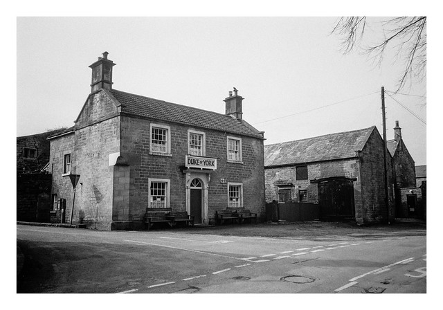
Although Elton isn’t too far, much of the drive there is on smaller roads, so it took about an hour to get there and park up. The weather was a little overcast when I arrived, but with the promise of some brighter spells later. The starting point for the hike is outside the Duke of York pub, across from the village church.
Not long after this, there was a slightly confusing branch of the path in a field that first had me wandering around some farm machinery before wandering off down the wrong fork. It was a little while later, after descending a hill and then crossing a large pool of muddy ground near the entrance to a field that I realised my error. Luckily, re-checking my map, I could see that the narrow road I was now on would curve around and intersect the original footpath, so I stayed on this course. This wasn’t a bad thing as, part way up a hill at a bend in the road, I came across a series of water troughs, fed by a spring.
These troughs are called the Burycliffe Troughs and the spring that fills them has never been known to run dry. Until 1940, these were Elton’s main source of drinking water, and men, women, and children would walk here in all weathers to collect water in buckets and then carry them back up the hill to the village. One enterprising farmer would fill urns of water and transport them in a cart, selling them for a penny a bucketful.
A little further up the road I rejoined my original route and broke off into a field to the left. The path led through another field where this tree stood near the ridge of the hill.
As the path descended, it reached another track, this one leading to a Christian sanctuary / retreat. On the other side of the track a lone piece of farm machinery stood on the grass.
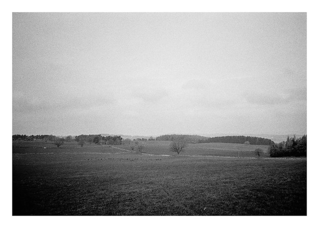
While crossing the next field I spotted a herd of animals off to my left. I soon realised that these were deer. I took a photograph but it should be noted that the Olympus XA3 is not a useful wildlife camera. You can see the deer in this picture though – they are the black pixels about a quarter of the way up the frame. 😀
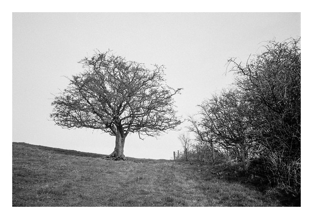
One thing you find a lot of in the Peak District (and, to be fair, a lot of the British countryside) are drystone walls. This arrangement of walls with a lone tree looked like a decent photograph to take.
In the opposite direction, a track led to a farm sitting atop the ridge of a hill.
A little further along the route, the path I needed to follow crossed a small stream before curving up and to the east through some woodland. There were signs of forestry activity here, and it marked a good place to park myself on a fallen log and take a drink of water. It also marks the place where I’ll leave the first part of this post. In part two there will be stone circles, rock outcrops, and a hermitage!
The first part of this post detailed the walk from West Stockwith to Misterton. This part covers the walk though the rest of Misterton and back to my starting point.
I’ll begin with All Saint’s church, a Grade 1 listed building that dates back to the 13th century (although it was largely rebuilt in the mid-19th century. It was a little awkward trying to compose a shot of the church from the entrance to the grounds to the east (the perils of a fixed-lens camera), but a better view was possible from the west, albeit with the church partially obscured by a couple of evergreen trees.
I sometimes go inside churches if they are open, as there is usually something of interest to look at and photograph, but I didn’t have time on this trip. Instead I took the following picture of one of the stained glass windows from the outside. This is perhaps not the best way to appreciate stained glass, but I quite liked the patterns of the lead-work.
Leaving the church along Church Lane, I rejoined the main road through Misterton (the B1403). The road changes names from Church Street to Gringley Road near here and an old-style black and white fingerpost donates directions to various places. I think this one is ready for a lick of fresh paint.
Following Gringley Road south passes a variety of interesting old houses before reaching a bridge that crosses the Chesterfield Canal. It was here that I left the road to join the Cuckoo Way footpath that follows the canal all the way from its source in Chesterfield in Derbyshire.
The canal skirts the southern side of Misterton, passing beneath a few bridges, such as this one that carries Grovewood Road.
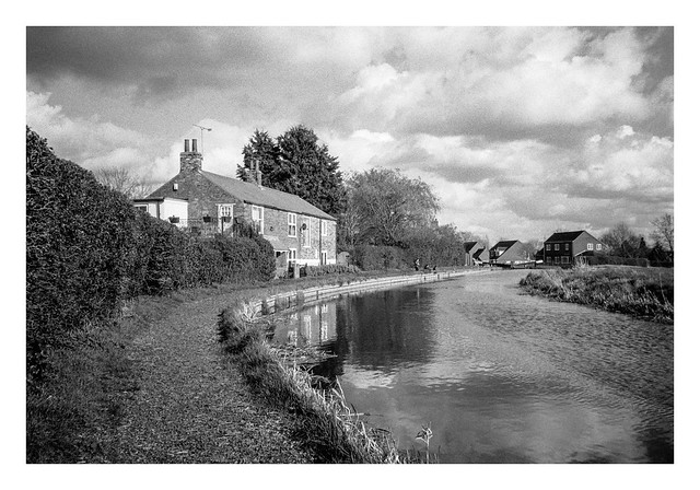
Further down the canal, it curves attractively past some houses where a man and two boys were fishing, before reaching a series of locks. One of the houses between these locks had a small boat moored beside it’s back garden
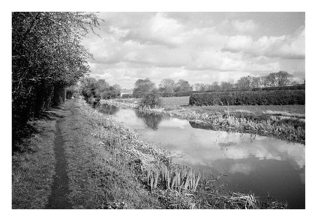
The canal then follows a straight route back towards West Stockwith. There were many narrow-boats moored along this stretch.
There’s a final bridge carrying the main road through West Stockwith before the canal enters Stockwith Basin, a marina that opens directly into the River Trent via locks.
The final stretch of the footpath route follows the flood-bank on the west side of the Trent. The Trent is the third longest river in the UK, flowing 185 miles from its source on Biddulph Moor in Staffordshire, to Trent Falls in Lincolnshire, where it discharges into the Humber Estuary. The river is navigable to Burton on Trent in Staffordshire.
Leaving the riverbank before the mouth of the River Idle, I crossed the bridge across the Idle and back to my start point in West Stockwith.
I enjoyed this walk. The weather was pleasant, the light was nice for photography, and there was plenty to see along the way.
This is the second of my “Walk With a Camera” series, and a hike I plucked from the routes available on the excellent Ordnance Survey app. West Stockwith is a location I’ve had earmarked for a visit for a while, so finding a circular walking route on the app sealed the deal, and I set off on a pleasant Sunday in March to see what I might find.
The route is an easy one, being less than five miles in length and with an uphill elevation of only 85 feet.
West Stockwith is a village in Nottinghamshire which sits beside the River Trent. It’s sister, East Stockwith, sits on the opposite bank, although there is no easy way to travel between them. A ferry used to operate, but the service ceased in the 1950s. A journey south to Gainsborough, where the closest bridge stands, is the quickest route.
West Stockwith also marks the location where two other waterways join the Trent. The River Idle would form part of my route on the westbound leg of the walk, and the Chesterfield Canal would return me back east to where I started. These waterways once provided industry for the village, but traffic along them in modern times is leisure based.
As the River Trent is still tidal at this point, there are a number of barriers in place to allow water levels to be managed and to allow passage for boats. This entrance sluice is the final barrier before the River Idle enters the Trent.
After photographing the sluice gate, I set off along the footpath that follows the Idle to the west. The initial part of the footpath squeezes past a riverside property and is not immediately apparent. This Google Streetview image shows the entrance under the arch beside the blue door.
A little further upstream beyond the sluice is a pumping station which not only helps manage the water levels on the Idle, but also provides passage for river traffic. Indeed, the whole stretch of river between the pumping station and the sluice can act as a single large lock allowing multiple boats to traverse between the Trent and the rest of the Idle at the same time.
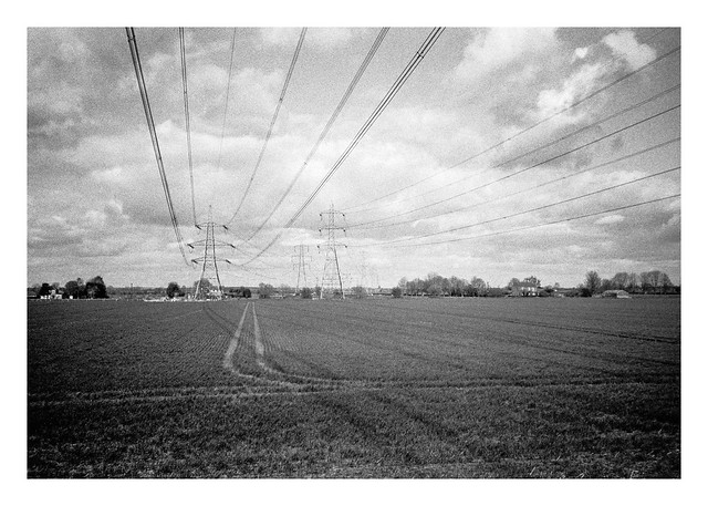
Past the pumping station, the footpath follows the river from atop an earthen flood bank, the river to the south and open fields to the north. A series of powerlines cross these fields, running from West Burton and Cottam Power stations to the south (although both are now scheduled for demolition, at least in part).
Before too long the sight of two large chimneys comes into view on the far bank of the river.
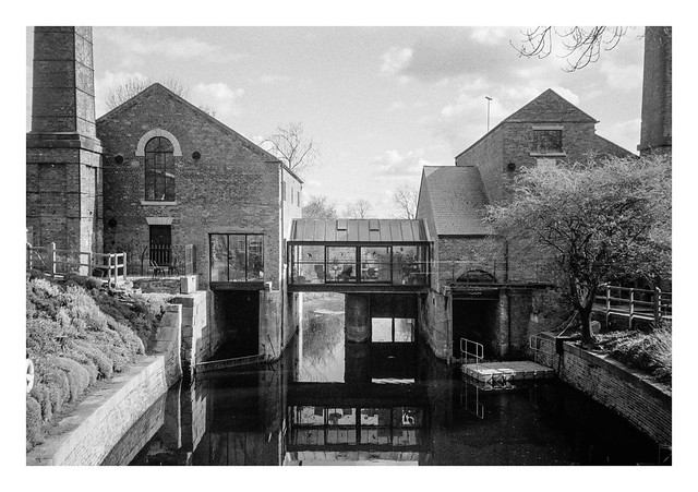
A short while later, there is a bridge across the river which then took me back east a short distance before I turned south along a lane that passes the building with the chimneys. Once a pump house, this is now a posh-looking residence named the Pump House Art Studio that is available to rent for short stays. The water flowing beneath the structure is not the River Idle, but a man-made channel named the Mother Drain.
The lane heads southwards through a couple of 90-degree bends, dips under a railway bridge, before entering the eastern side of the village of Misterton. After passing an interesting looking residential home, the route of the walk heads further into Misterton before turning off the roads and back into some fields to the north of the village. The path skirts the village for a while before re-entering it at it’s north eastern side and onto a pleasant looking road.
Walking south down this road brought me to a junction with a saddlery on one of the corners. I don’t see many saddleries in the city where I live, so it was worth a photograph, especially with the horses head stuck on the front of the building. Being a Sunday afternoon, the place was closed, but I can imagine there being an interesting display behind the shuttered window.
Across the road from the saddlery is the village church, which is where I’ll continue in part 2…
Continuing from yesterday, the second part of this post will cover the leg of the journey from Stoney Middleton back to Eyam.
The footpath I had been following enters Stoney Middleton via backstreets. Where this street merges into another named The Fold, there is a sign affixed to a wall pointing the way back to Eyam to those unsure of the route
At the bottom of The Fold there is a small open area where Dale Brook flows before disappearing beneath the William Lennon and Co boot factory. The building was formerly a corn mill before William bought it in 1904 along with the Mason brothers, forming Mason Bros & Lennon, where they began repairing, and then manufacturing boots. The factory still operates and is in the hands of Williams great grandchildren, focusing on retro footwear produced using traditional techniques.
The western end of this grassy area is separated from the grounds of the boot factory, and contains a sapling planted to commemorate the Diamond Jubilee of Elizabeth II. Here also sits Toll Bar Fish & Chips, from which a very tempting aroma was drifting. I’ve had chips from here once before and they were very good, but on this occasion it was still a little early for lunch.
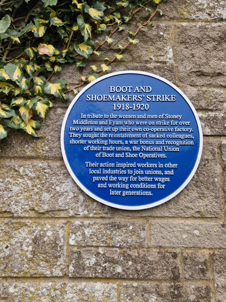
More heritage trail signs are present, as well as a blue plaque on the side of the Boot factory remembering the Boot and Shoemaker’s Strike between 1918-1920.
The next shot shows some houses across the road from the chip shop, illustrating the precipitous nature of parts of the village.
St. Martin’s church was the next landmark on my walk. The church was open to visitors and I went inside and made a few pictures with my Yashica Mat 124G, which I’ll post on another occasion. The church is quite unusual in that the nave is octagonal, which you can just about make out in the picture below.
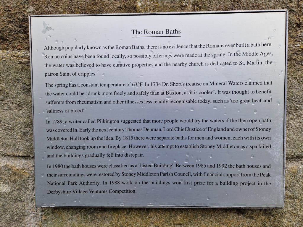
On the road past the church is a small building with a spring flowing beside it. The structure is known as the Roman Baths. I didn’t photograph it, but grabbed a quick picture of the plaque outside with my phone camera.
At the end of this road the tarmac ends and I was back onto a track again. Near the bottom is a cemetery containing Commonwealth War Graves. It has a mossy lychgate that made for an interesting picture.
From here the track, and old packhorse trail, ascends quite quickly. It’s rocky and bumpy and soon had my legs aching and my lungs panting. The next photo is looking back the way I came. This section was a bit less steep.
At the top of this track is a road, and there is a footpath through the fields on the other side that continues the ascent. Again, this next shot was a look back the way I had come.
At the top of this path is a wooded area with the trail eventually joining Riley Road. This road runs back towards Eyam and is thankfully downhill all the way, but near the top it passes a field which is the site of the Riley Graves. This small enclosed graveyard contains the gravestones of seven members of the Hancock family who lost their lives as a result of the plague within seven days of one another in August 1666. Elizabeth Hancock buried her husband and six of her children here. After the plague passed, Elizabeth moved to Sheffield with her remaining son.
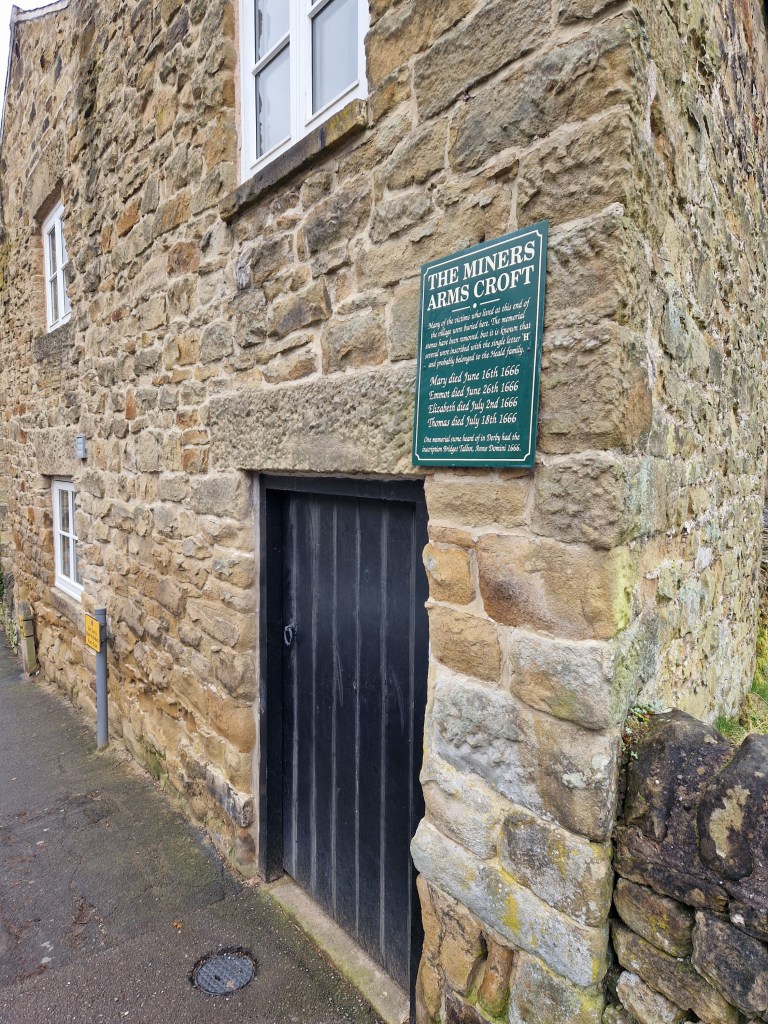
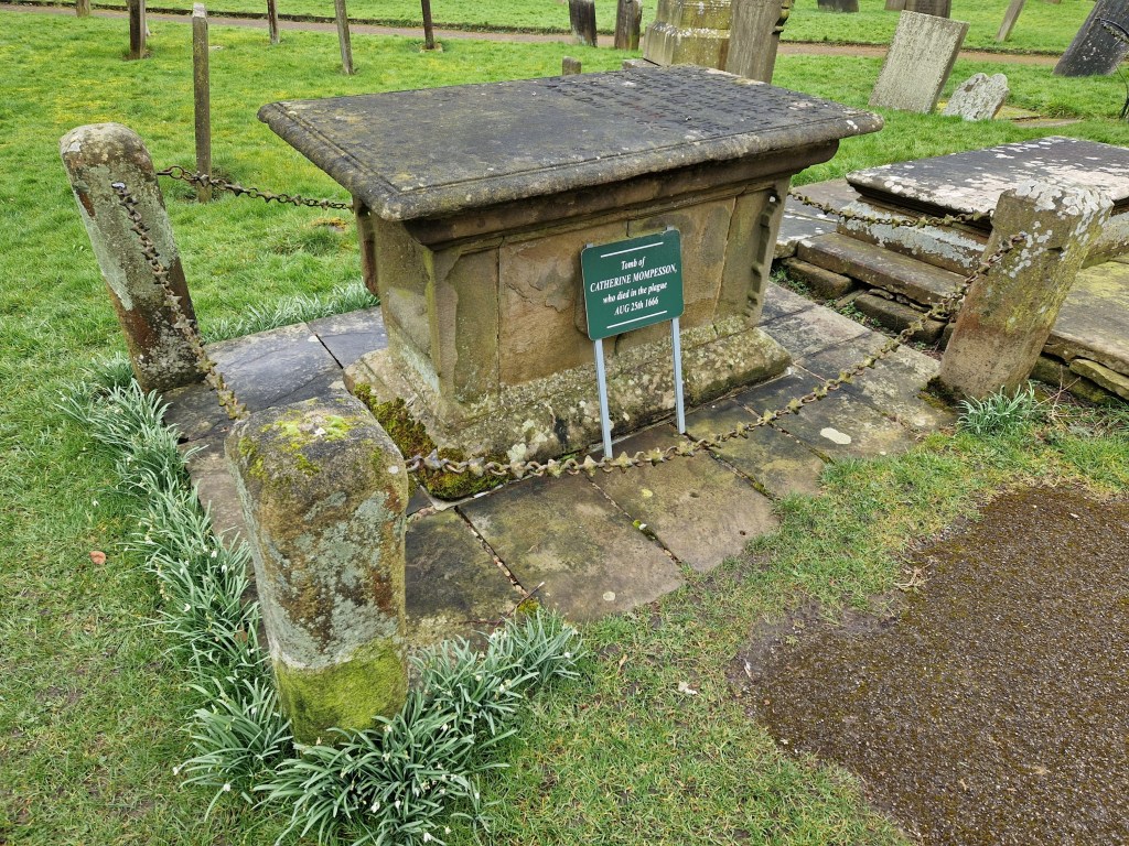
Many of the buildings and places in Eyam have information plaques affixed, providing information on the events of the plague, such as these at The Miner’s Arms and within the parish church graveyard.
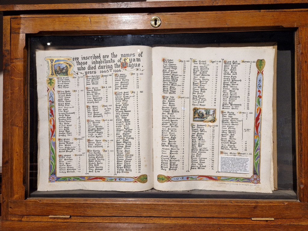
Within the church can be a found listing the inhabitants of the village who fell victim to the plague.
On that sad note I’ll bring this two-part post to a close. I plan on doing a bunch of these walks this year (indeed, I’ve already done three more!), so look out for those soon.
This year (and hopefully more to come) I’m planning on taking a bunch of walks / hikes with a camera. This is not a particularly new idea – I do this all the time already – but my methodology previously has been more based on random choice. Not quite stick a pin in a map, but certainly unguided insofar as points of interest on the walks I chose. Some of these self-directed walks were good and there were plenty of things to see along the way (and it’s always great when you come around a corner to find an interesting scene before you). But I’ve also been conscious that I might have been missing out on stuff that I would have seen if I’d only gone by a different route.
So the hikes I’m undertaking this year are based on guidebooks, or the recommended walks that can be found in the Ordnance Survey (OS) app that I subscribe to. Some of the walks are quite short – just a few miles – while others are longer, although none are too taxing, and nothing that can’t be achieved within the course of a day out.
I’ve also started to purchase some equipment for these outings. I’ve discovered how uncomfortable the wrong clothing can be in the right conditions. I want to be able to keep warm or cool as appropriate, and be able to stay dry in the UK’s changeable weather, so I’ve been investing in some proper outdoor clothing – base-layers, mid-layers, waterproof shells and the like. I’ll probably have to buy more stuff as the conditions change through the year, but at the end I should have a wardrobe of clothing to suit most conditions that I’ll encounter. I’ve also bought a pair of hiking poles. I wondered if these might have been overkill, but the first time I used them they were a godsend.
One thing I want to buy is a good quality backpack. Not necessarily a photography backpack, but one that will serve that purpose as well as giving me space to carry other provisions. Until then I’ll make do with the backpack I already own.
Anyway, this has been a somewhat lengthy preamble. TLDR – I’m going to go for some walks, take pictures along the way, and write about it here. 🙂
The initial hike I chose is the first walk in my OS Peak District Outstanding Circular Walks book: Eyam and Stoney Middleton.
This first walk sits in the “short walks” category of the book, with hikes of less than 2.5 hours (although I don’t think they accounted for photography in those timings 🙂 ). It’s only 3.5 miles, with a height gain of 660 feet (although, to be fair, that gain is pretty much all in one leg-busting uphill section).
The day of the hike was typically British overcast weather. This isn’t the sort of day that inspires photography to be honest, but I’ve also decided hereon that I will make the best of the conditions I have rather than take my usual approach of moaning about it, so it was on this damp and grey day that I arrived in the village of Eyam to begin my walk.
There is evidence of human settlement at Eyam dating back to the Ancient Britons but it was in the 17th century that the village gained fame. In 1666 the Great Plague of London, an outbreak of Bubonic Plague, took place. During the outbreak a bolt of cloth containing infected fleas was delivered to the tailor in Eyam, resulting in a local outbreak of the disease. Although there is some debate about the numbers affected, nearly three hundred villagers are recorded as having lost their lives as a result. A number of measures were introduced by the village to attempt to halt the spread, including a requirement that families isolate and bury their own deceased members. The most important however, was likely the decision to quarantine the entire village to prevent outside transmission. It is this sacrifice that give Eyam its fame.
I began my walk down Church Street, the main road through the village. It’s lined with houses in a variety of styles, from stone built cottages, through to the grand looking Eyam Hall, which now serves as a wedding venue.
A map, an information board, and a set of stocks sit just to the right of frame in the image above.
Eyam Hall probably looks nicer in good light, but it’s still an impressive presence on a dull day.
A village shop is present and doing business, but what I assume to be the post office was closed.
The door to the Mechanic’s Institute was open and there was some activities taking place inside (although not mechanics, I don’t think).
Further down the village I reached the point where I would take a right onto Lydgate and head along the footpath that leads to the neighbouring village of Stoney Middleton.
The footpath was a little muddy on the day, and I was glad of my hiking boots, but it was easy to traverse. Not far out of Eyam I could see the ruin of a farmhouse in the middle of a field.
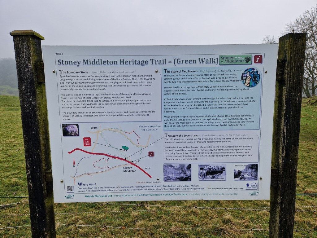
A little further along the track sits the Boundary Stone. This boulder was used to exchange money for goods between the villages of Eyam and Stoney Middleton. There are a number of holes in the top of the stone and these were filled with vinegar in order to sterilise the money.
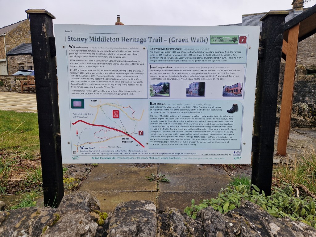
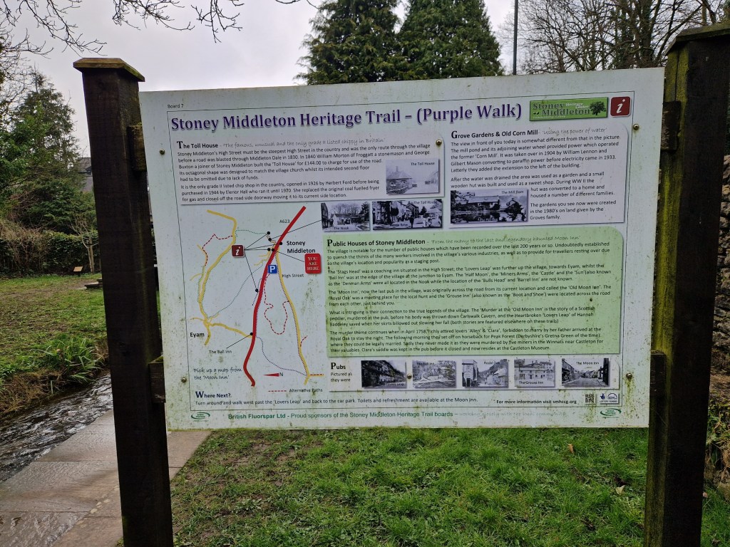
There are a number of information boards present along this footpath, denoted as the Stoney Middleton Heritage Trail, which contain interesting facts along with some tragic stories.
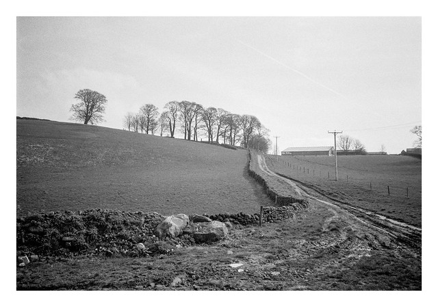
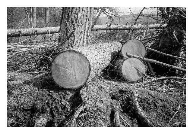
As the footpath crests the ridge before a steep descent to Stoney Middleton, a tree had fallen. It’s surprising how little of a tree’s structure is underground sometimes, and this one had it’s work cut out to find purchase for so long in the stony soil.
I’ll end this first part of the post with a picture of the path down into Stoney Middleton, which you can just see emerging from the murky day at the bottom.