As the Hot Chip song goes, “Over and over and over and over. Like a monkey with a miniature cymbal. The joy of repetition really is in you.“, so it seems that I photograph the same things over and over too. The flyover at the southern end of Woodhouse Washlands is one such subject. It is an interesting subject, I think, and I don’t think I’ve exhausted it yet, but I wonder if there is a limit on how many times I can photograph it before the repetition becomes too much?
What, at first glance, looks like a muddy obstacle when out for a walk, might also be seen as two figures shaking hands. On what, who knows? Giving me wet feet probably.
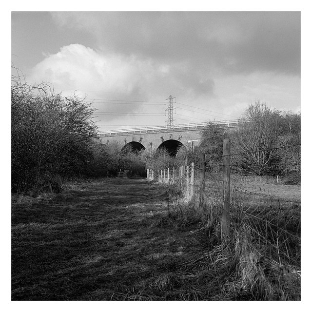
The railway viaduct that crosses Woodhouse Washlands is always a little disappointing, photographically speaking. The best vantage point is probably from atop the road viaduct, but there is no pedestrian access to that. From ground level, the railway viaduct becomes obscured by hawthorn trees and I think the shots included here below are from perhaps the best location, but still not ideal.
At this time of the year, bare trees allow a little more visibility that becomes lost when they’re full of foliage.
Sunday has become the day where I write up my thoughts on the album I’ve been listening to this week on my other blog. As those tend to be much more wordy affairs than what I post each day about photography, Sunday’s posts here are likely to be somewhat short.
I can say, even though I’ve not written how I feel about this week’s album yet (Talk Talk’s Spirit of Eden), that it’s a great piece of music.
I was going to post this yesterday, but it seemed somehow inappropriate to name a post “Bunny girl” given it was International Women’s Day, even though there’s no ill intent intended. It just seems a fitting title for the picture.
It’s a piece of artwork on one of the supports of the Mosborough Bypass. It’s right next to the River Rother and I’ve not walked this far along the viaduct before, having normally angled away across the washlands at this point on a walk, so I’ve not seen this piece before and don’t know how long it’s been in place. The way the light was hitting the concrete lit it up nicely though, and the Yashica Mat has rendered a crisp image.
I’m not sure that “Bunny girl” is the right title though – those look more like mouse ears or something.
This viaduct is a familiar subject for my photographs (and this blog) it being only a mile or two from where I live, but it’s interesting enough for me to have taken a number of pictures at the location. I fully expect that I will take more, and that those will feature here on the blog also at some point.
I like the subtle curve of the roadway on this picture, plus I’m very happy that I didn’t behead that street light when composing the shot.
Incidentally, the location ///bypass.viaduct.curve is in the wilds of Siberia if you use the What Three Words app to look up the location that shares the three words of today’s post.
A few weeks back I decided to go for a walk on the Trans Pennine Trail. I’ve walked the stretch close to where I live before, reaching as far as Renishaw a few miles to the south, but I’ve never followed it any further than that.
So, on the day in question, I decided that I would see what was down there, walking the stretch between Renishaw and Staveley and then following the Cuckoo Way on the return journey.
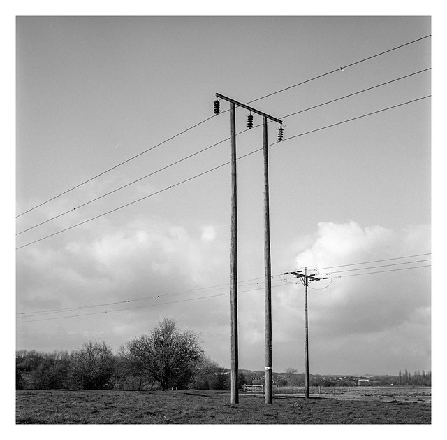
Looking east from the Trans-Pennine Trail towards the village of Mastin Moor. The Cuckoo Way meanders its way north over near where those pylons stand.
The Trans-Pennine Trail follows the path of an old railway along this stretch of it’s route and is relatively straight as a result. It’s also flat and doesn’t tend to get muddy at all. The Cuckoo Way, on the other hand, follows the route of the Chesterfield Canal and can be hiked all the way from Chesterfield to the River Trent – about forty five miles away as the route takes you.
Looking west from the Cuckoo Way. The Trans Pennine Way is where the row of trees is on the horizon. The houses are on the outskirts of Staveley.
The Cuckoo Way is easy to walk in many places, particularly sections where the canal still exists, but this stretch just winds through fields, sometimes with little sign of where the waterway once flowed. This particular stretch was quite muddy. Not wet sloppy mud, but the thick stuff like you find on a playing field after a game of football has been played when the ground isn’t dry. It quickly clogged up the soles of my hiking boots with it’s thick clay-like weight and took quite some time to wash off when I got back home.
Heading back north and following the former route of the canal. Teh Cuckoo Way is just off-camera to the right.